Intersections and cycle paths

With over 4500 kilometres of cycle routes, it can be quite difficult to keep track of the route. For easier planning and a better overview during the cycle tour, you can use the practical junction system . This allows you to easily plan individual tours and circular tours. Of course, the cycle routes will take you to the most beautiful sights in Münsterland and at the same time you will experience the beautiful landscape of this region. For a better understanding, you will find a detailed description and explanation of the signposts used on this page. We wish you a wonderful cycling tour in Münsterland!

That's how it works!

The signposts lead you to the most beautiful castles and palaces, through beautiful natural areas and to the most important places in Münsterland. The junction system was developed for better orientation on the cycle routes. With the help of the junction numbers, you can easily plan even extensive cycle tours. And to make sure you always stay on the right track, there are signposts along the entire 4500 kilometres of cycle routes.

Destination signposts for cycle paths
© Münsterland e.V.

Junctions

This signpost is located at forks in the junction point system and provides a quick overview. Here you will find all the necessary information about the cycle route. At the top is the junction to your current location. The next accessible junctions are shown via pictograms. The destination sign shows you the long-distance and short-distance destinations with the respective distance information. A possible pictogram indicates that you are on a themed route. In this example, we are on a section of the 100 Castles Route, represented by the green castle symbol.

Intermediate signposts for cycle paths
© Münsterland e.V

Intermediate signposts

To ensure that you never stray from the route, there are intermediate signposts at regular intervals. These show the way to the next cross reference point and thus ensure that you find the right way quickly and easily.

Tour planner Münsterland

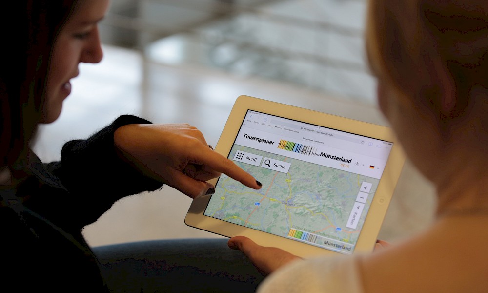
But it's not just the junctions that help you plan your cycle tour. The Münsterland tour planner makes it even easier for you: plan your personal route according to your wishes in terms of journey time, distance and/or sights along the route. With the mobile app, you always have your route with you on your smartphone!

Tour planner Münsterland
© Münsterland e.V.
To the tour planner
Learn more...

Your questions about the transport hubs in the Münsterland region

The junction network connects 667 junctions in the Münsterland region. The junction network covers the entire region.

The city of Münster also has junctions to help cyclists find their way around. These are located in the city centre along the Promenade, the city’s Old Town ring road.

The Münsterland Tour Planner is ideal for planning a cycle tour along the junctions in the Münsterland region.

Most of the Münsterland’s neighbouring regions also have cycle junction networks. This means you can easily extend your cycle tour as far as the Ruhr area or the County of Bentheim. The junction network is particularly dense in the Netherlands. The junction network covering the County of Bentheim and the neighbouring Dutch provinces can also be found in the Münsterland route planner.

The cycle route networks of the Münsterland and the neighbouring Dutch regions are closely interconnected. This makes cross-border cycle tours easy to undertake. The only difference is the colours of the junctions. In the Münsterland, the junctions are marked in red and white, whilst in the Netherlands they are marked in green and white. In the Münsterland route planner, junctions in the Netherlands can be found up to a distance of approximately 30 km.

Close Contact & Info
Close